Tuesday, March 20, 2018

Highlands Storm Likely Producing A Tornado

A "Donut hole" in the radar shows a very likely tornado east of Sebring moving into the Kissimmee State Park and northern Okeechobee county as well.

No damage reported so yet in Avon Park or Sebring, which is great news since the two cities are quite populated.

Tornado Warning Highlands

A storm possibly producing a tornado near Sebring will move to Okeechobee county once it exits. Strongest rotation we've seen today.

3:15pm Situation

Tornado Watch remains in effect until 7pm for most of the northern half of the state. Conditions are still favorable for tornadoes, damaging winds and large hail.

The Current Radar:
Break down by NWS Office:

TAMPA: Strong line of storms along Tampa and Bradenton, those will move inland into Sebring and south of Lakeland within the hour.

MELBOURNE: Two severe thunderstorm warnings, one SW of Orlando and one east of there. Both will go very near the Space Coast and Port Canaveral. Other showers were across Lake, Volusia and Seminole counties.

JACKSONVILLE: Other storms are developing into severe storms northwest of Jacksonville and Gainesville. The cold front is far northwest of there. Wouldn't be shocked to see other convection here pretty soon.

The threat continues. In several more hours, temperatures will cool down and a northern breeze will take over and everything will be fine after that and weather looks a whole lot better Tomorrow.

Tornado Warnings for Orlando

BULLETIN - EAS ACTIVATION REQUESTED
Tornado Warning
National Weather Service Melbourne FL
232 PM EDT TUE MAR 20 2018

The National Weather Service in Melbourne has issued a

* Tornado Warning for...
  Southwestern Lake County in east central Florida...

* Until 300 PM EDT

* At 231 PM EDT, a severe thunderstorm capable of producing a tornado
  was located over Groveland, moving east at 50 mph.

  HAZARD...Tornado and half dollar size hail.

  SOURCE...Radar indicated rotation.

  IMPACT...Flying debris will be dangerous to those caught without
           shelter. Mobile homes will be damaged or destroyed.
           Damage to roofs, windows, and vehicles will occur.  Tree
           damage is likely.

* This tornadic thunderstorm will remain over mainly rural areas of
  southwestern Lake County, including the following locations:
  Minneola.

PRECAUTIONARY/PREPAREDNESS ACTIONS...

TAKE COVER NOW! Move to an interior room on the lowest floor of a
sturdy building. Avoid windows. If you are outdoors, in a mobile
home, or in a vehicle, move to the closest substantial shelter and
protect yourself from flying debris.

&&

LAT...LON 2857 8195 2863 8166 2859 8165 2850 8166
      2847 8196
TIME...MOT...LOC 1831Z 254DEG 48KT 2853 8187

TORNADO...RADAR INDICATED
HAIL...1.25IN

$$

Combs
Tornado Warning
FLC095-117-201900-
/O.NEW.KMLB.TO.W.0003.180320T1826Z-180320T1900Z/

BULLETIN - EAS ACTIVATION REQUESTED
Tornado Warning
National Weather Service Melbourne FL
226 PM EDT TUE MAR 20 2018

The National Weather Service in Melbourne has issued a

* Tornado Warning for...
  Southwestern Seminole County in east central Florida...
  West central Orange County in east central Florida...

* Until 300 PM EDT

* At 224 PM EDT, a severe thunderstorm capable of producing a tornado
  was located over Windermere, moving east northeast at 40 mph.

  HAZARD...Tornado and ping pong ball size hail.

  SOURCE...Radar indicated rotation.

  IMPACT...Flying debris will be dangerous to those caught without
           shelter. Mobile homes will be damaged or destroyed.
           Damage to roofs, windows, and vehicles will occur.  Tree
           damage is likely.

* Locations impacted include...College Park, Oak Ridge, Pine Hills, Winter
  Park, Azalea Park, Goldenrod, Union Park.

Other locations impacted by this tornadic thunderstorm include
Edgewood.

PRECAUTIONARY/PREPAREDNESS ACTIONS...

Motorists should not take shelter under highway overpasses. If you
cannot safely drive away from the tornado, as a last resort, either
park your vehicle and stay put, or abandon your vehicle and lie down
in a low lying area and protect yourself from flying debris.

&&

LAT...LON 2846 8162 2861 8162 2869 8124 2848 8124
TIME...MOT...LOC 1824Z 258DEG 30KT 2852 8155

TORNADO...RADAR INDICATED
HAIL...1.50IN

Tornado Watch For Florida

There was a tornado warning for Daytona about 90 minutes ago, it had since moved out and didn't cause a tornado as far as we know.

However a tornado watch has been issued for most of northern and central Florida until 7pm tonight. The atmosphere looks loaded for a few tornadoes with a couple strong possible, damaging winds to 70mph and large hail to 1.5 inches in diameter are all in the forecast.

All modes of severe weather are likely within the watch area. Pay very close attention to the weather this afternoon. If a warning is issued, don't hesitate to take action.

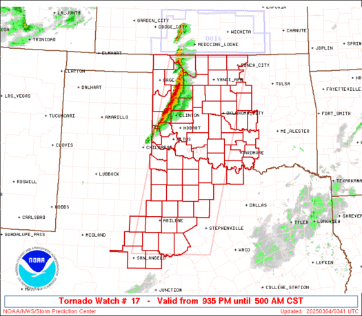
Here's the watch:
http://www.spc.noaa.gov/products/watch/ww0017_radar.gif

So I would like to tell you that it's over, it's actually just began.

Dangerous Day Today

* Not much has changed in our forecast for this afternoon. The Storm Prediction Center (SPC) has maintained an enhanced risk of severe thunderstorms for most of the northern Florida, that includes Jacksonville, St. Augustine, Gainesville, Tampa, Orlando and Daytona Beach. The maps is below.

1st Image: Overall Risk
2nd Image: Tornado Risk
3rd Image: Wind Risk
4th Image: Hail Risk


You can see the rough line of division is Interstate 4 (Daytona, Orlando and Tampa points north) HOWEVER thunderstorms do not know where these lines are, this is just a guideline. It doesn't indicate what could be in one county and not another, that's what a warning is for. Again, watches and warnings are much more important than this.

This is actually not a slam dunk forecast, but this is a very complex situation still. And the mesoscale (Small scale) features REALLY determine the severity of the outbreak and that we won't know until later today.

NOT every county in the enhanced/slight risk area will report severe weather but ANY county in it could. That is why it's critical to have a plan in place for today.

Don't cancel any plans for tonight or change them just yet but if you have any, make sure you're very aware of the situation at that very moment.

* Setup: This morning, a low pressure system is over Tennessee, a very favorable quadrant for severe weather (Southeast). Wind shear (Winds changing with height) are moderately strong so we're not expecting a big tornado threat unlike last night across Mississippi/Alabama/Tennessee but a few tornadoes could still happen. Strong (Damaging) winds are a real possibility if not a probability at some point this afternoon. An enhanced risk means that there is a 30% chance of severe weather within 25 miles of a given point in the risk zone. That might seem low but for severe weather, that;s up there. Isolated hail (Ice Pellets) are possible but not widespread because of the mid-levels being relatively warm core.

* Timing: We thought it was going to be morning time for Daytona Beach but now it appears to be early afternoon. More precise windows are below
Jacksonville: 9am-2pm
Gainesville: 10am-2pm
Daytona Beach: 12pm-5pm
Orlando: 2-7pm
Tampa: 3-7pm
Sebring: 3-8pm
Melbourne: 3-8pm

Please give some elbow room (Allow an hour or two on either side of this.)

* Main Threats:
Damaging Winds (Especially in microbursts) up to 60 mph possible
Hail to 1.5 Inches in the strongest storms
Frequent Lightning
Heavy Rain
A few tornadoes possible

From NWS Melbourne:
Enhanced Threat of Severe Weather Across East Central Florida
This Afternoon and Evening...

A squall line is expected to develop ahead of a cold front and
move into areas northwest of I-4 early this afternoon. The line
will push southward with a potential secondary band of showers and
storms farther south over the Gulf moving rapidly eastward. This
will lead to numerous showers and storms pushing quickly toward
the east-northeast across east central Florida around 55 to 60 mph
through mid to late afternoon. This activity will then shift
south and offshore of the Treasure Coast by late evening.

Strong to possibly severe storms will occur with this activity.
Damaging wind gusts up to 60 to 70 mph and frequent lightning
strikes will be the main threat from any severe storms, but large
hail and isolated tornadoes will also be possible. Make sure you
have a way of receiving timely severe weather watches and
warnings, should any be issued for the area.

* Misconceptions:
Are risk categories important? On the day of the event, not really. Thunderstorms don't know where those lines are. Just a guideline. Don't get too carried away by it.

Are mobile homes safe? NO!!! The reason why is that air can get underneath a mobile home and flip it. Mobile homes are not safe AT ALL during a weather situation. Evacuate them as soon as possible and find a more substantial shelter. Every person living in them should have a plan on what to do, whether it's 3am, 3pm, weekday, weekend, or holiday.

Are warning for entire counties? Also a no, warnings for not for entire counties, there are for sections of counties. Storm based warnings were adopted 10 years ago by the NWS to reduce the area warned. THERE IS NO REASON to warn an entire county. It does hospitals a disservice by stopping surgeries during a tornado warning 30-40 miles away in some cases and not moving towards the area. Also it created a false alarms for schools and citizens alike so when you hear a warning iss issued for where you live, you want to take it seriously.

Storms can't pack a punch early in the morning... Oh yes they can. Some of the most imfamous storms caused by damaging winds happened in the morning hours. The April 27 2011 outbreak over Alabama had a widespread wind event in the morning. Also several events in 2012 and 2013 rolled though Indiana, Ohio, Virginia, Pennsylvania and Maryland during the time frame. Severe storms can impact areas any time they feel like when conditions are correct.

Current Radar:
Pretty quiet at the moment. The storms that do develop in the Big Bend Region of the state (Near the Gulf) are the ones we really to watch out.


I can almost guarantee that we will be under some sort of weather watch (Not sure on Severe Thunderstorm or Tornado) later this morning as conditions destabilize.

This is a serious situation. Pay very close attention to the latest developments to it. if a warning is issued, don't hesitate to take action.

Plan now, make the decisions now, try not to get caught up in traffic, make decisions with respect to your family, house and where you work okay?

There is no reason to be scared. just follow along if a warning is issued, execute your plan. That is all.

* Links To Follow:
NWS Melbourne Twitter
NWS Melbourne Facebook
My Twitter
WFTV (Channel 9 Orlando) Weather
What To Do During A Severe Thunderstorm

Monday, March 19, 2018

Eastern Alabama Tornado (Large and Destructive)

Directly from the NWS Office in Birmingham

Severe Weather Statement
National Weather Service Birmingham AL
906 PM CDT MON MAR 19 2018

ALC029-200245-
/O.CON.KBMX.TO.W.0006.000000T0000Z-180320T0245Z/
Cleburne AL-
906 PM CDT MON MAR 19 2018

...A TORNADO WARNING REMAINS IN EFFECT UNTIL 945 PM CDT FOR
NORTHEASTERN CLEBURNE COUNTY...
       
At 905 PM CDT, a confirmed large and extremely dangerous tornado was
located over Mars Hills, or 12 miles west of Buchanan, moving east at
40 mph.

This is a PARTICULARLY DANGEROUS SITUATION. TAKE COVER NOW!

HAZARD...Damaging tornado.

SOURCE...Radar confirmed tornado.

IMPACT...You are in a life-threatening situation. Flying debris may
         be deadly to those caught without shelter. Mobile homes
         will be destroyed. Considerable damage to homes,
         businesses, and vehicles is likely and complete destruction
         is possible.

Locations impacted include...
Fruithurst, Muscadine, Mars Hills, Liberty Hill, Oak Level,
Sweetwater Lake and Coleman Lake And Campground.

PRECAUTIONARY/PREPAREDNESS ACTIONS...

To repeat, a large, extremely dangerous and potentially deadly
tornado is on the ground. To protect your life, TAKE COVER NOW! Move
to a basement or an interior room on the lowest floor of a sturdy
building. Avoid windows. If you are outdoors, in a mobile home, or in
a vehicle, move to the closest substantial shelter and protect
yourself from flying debris.

&&

LAT...LON 3374 8564 3377 8564 3378 8562 3379 8562
      3379 8560 3380 8560 3380 8559 3384 8559
      3385 8564 3388 8564 3388 8560 3389 8560
      3389 8553 3392 8553 3392 8539 3369 8534
TIME...MOT...LOC 0205Z 273DEG 35KT 3380 8541

TORNADO...OBSERVED
TORNADO DAMAGE THREAT...CONSIDERABLE
HAIL...1.00IN

$$

87/GRANTHAM